Outdoor Activities


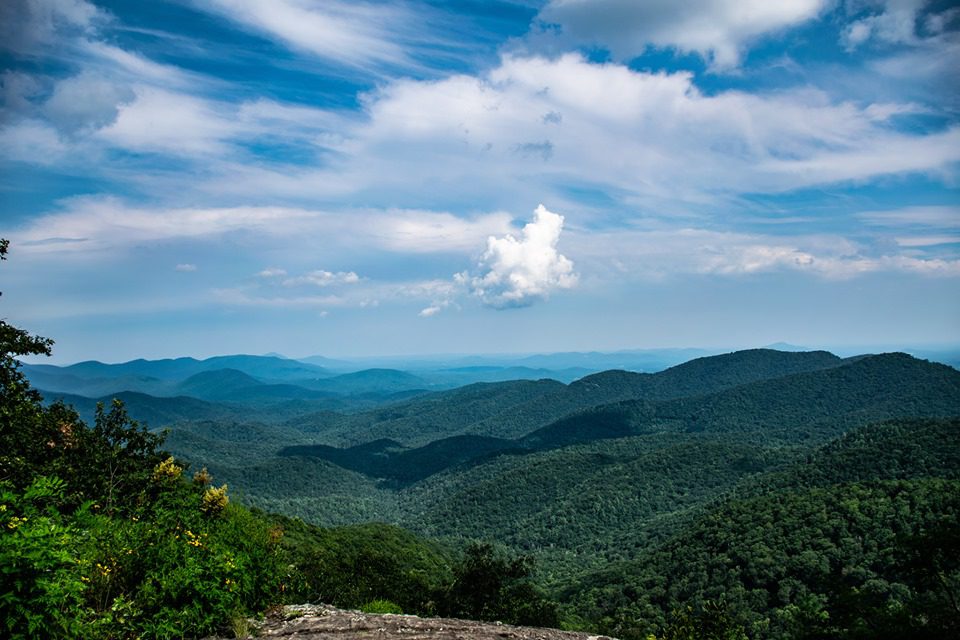
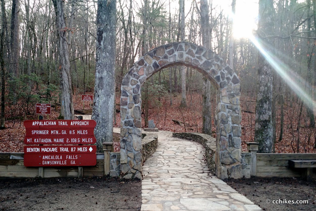
Did you know the Appalachian Trail starts at Amicalola Falls in Dawsonville, Georgia? The hike to Maine starts just 6 miles from Forrest Hills Resort!
Access to the Appalachian trail in the Dahlonega area
The Appalachian Trail can be accessed from paved state highways at Neels Gap on U. S. Highway 19 and Woody’s Gap on Ga. Highway 60. Gravel surfaced National Forest roads provide access to the trail at Gooch Gap, Cooper Gap, Hightower Gap, Three Forks area and Springer Mountain parking lot.
A Chattahoochee National Forest map showing the AT and Forest Service roads can be purchased at the U. S. Forest Service Visitor Center in Dahlonega.
The hike to Preachers Rock starts at Woody’s Gap in Suches
All of the streams described below are easily accessible from Dahlonega, Ga. and contain stocked rainbow and native rainbow and brown trout except where noted. A valid Georgia Fishing License with a trout stamp is required. Holders of an honorary fishing license do not require trout stamps. Certain streams are open only during fishing season which is from the last Saturday in March until Oct. 31.
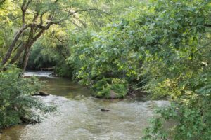
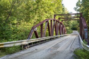
Nimblewill Creek ~ Just minutes from Forrest Hills Resort
FROM FORREST HILLS Go left onto Hwy 52W for a couple of miles to Nimblewill Rd. on the left. Take Nimblewill Rd. 2.3 miles to Nimblewill Church on the right. Continue straight on unpaved FS 28-2 crossing over Nimblewill Creek after 1 mile. Continue on FS 28-2 for 3 more miles. Nimblewill Creek will appear along the right side of the road. Camping is available along the creek. Open only during fishing season.
The Edge of the World and Devil’s Elbow are local favorite spots for fishing, fly fishing, nature trails and photography. Just 15 minutes from Forrest Hills Resort
All directions below are from downtown Dahlonega. We are located 12 miles west of Dahlonega and closest to the Nimblewill location.
BLACK MOUNTAIN TROUT PONDS
Black Mountain Trout Ponds has multiple ponds full of fresh trout ready for your family. They are a great place for family fun for all ages. They provide everything needed to enjoy your experience. 706-747-2582, or visit online here.
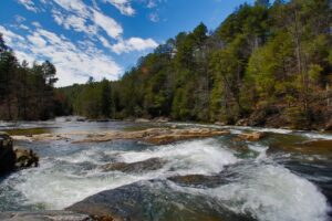
Etowah River
Fishing above Jay Bridge and the Etowah tributaries upstream from the Castleberry bridge to Jay Bridge is limited to the fishing season. The best fishing is probably in the Wildlife Management Area (WMA).
To reach this area from Dahlonega follow Hwy. Business US 19N 2 .1 miles and turn left on Wahsega Rd. Continue 8 miles to entrance of Ranger Camp, turn left on FS 28-1 and go 1.6 miles to the Etowah River. Primitive camping areas are upstream on the right. Tributaries include Jones Creek, Montgomery Creek and Nimblewill Creek.
Dicks Creek
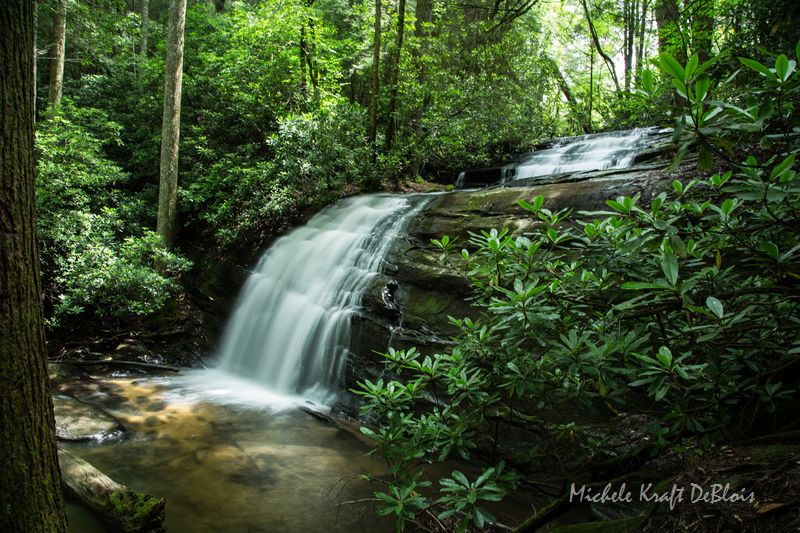
Dicks Creek is in the Chestatee WMA and is open only during the fishing season. This creek has a number of pretty falls and is easily accessible.
To reach it follow US Hwy. 19 N from Dahlonega for 12 miles to the Forest Service sign and sign for Mt. Piscah Church on the left . Turn left and follow this paved road. The road crosses over Dicks Creek in about 0.6 miles. Continue on this road with Dicks Creek on the left. The creek is mostly on private property almost to the confluence of Dicks Creek and Waters Creek at the bridge 2.7 miles from Hwy. 19. Dicks Creek falls is just downstream from this junction. For access to Waters Creek turn left at the bridge on FS 144 and check in at the ranger station past a private residence. FS 144 is closed except during fishing season. The road along Dicks Creek continues for 2 more miles as unpaved FS 34 which is not maintained for automobiles.
Dockery Lake
This lake which is managed by the U. S. Forest Service is a great lake for kids. Camping, hiking and fishing platforms are available. Fishing Rodeos are held occasionally in the summer. Follow Ga. Hwy. 60N from Dahlonega for about 9 miles. Forest Sign on the Right.
Lake Winfield Scott
This pretty mountain lake is stocked with rainbow trout and is managed by the U. S. Forest Service. Hiking, camping and fishing platform are available. Boats with motors are not allowed. To reach Lake Winfield Scott, follow Ga. Hwy. 60N from Dahlonega through Suches. Turn right on Hwy. 180 and turn right at Forest Service Sign. Distance from Dahlonega is approximately 22 miles.
Reel Angling Adventures offers full- and half-day guided fly-fishing on the region’s finest trout waters close to Forrest Hills … or spend the day exploring remote spring creeks on our unique Wild Trout Trek.
How about a riverway float trip? Perhaps, trophy trout are your passion on unique private fishing sites that offer great river and stream fishing for rainbows and browns in the 3- to 10-pound class and larger!
All fishing trips include transportation, rods/reels and beverages. Call toll free for more details at 866-899-5259 or visit their website: Reel Angling Adventures in Blue Ridge Georgia
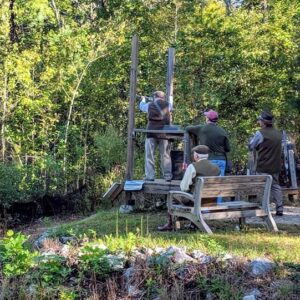
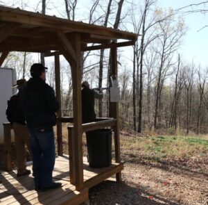
COMPLETE RANGE FACILITY…The Etowah Valley Sporting Clays Park features 5 stand, wobble trap and 12-station sporting clays ranges. Our emphasis is to provide a quality sporting clays park that is open to the public.
FAMILY FUN!…The Sporting Clays Park is designed for the whole family, from the youthful beginner to the experienced shooter.
OPEN TO THE PUBLIC… The Sporting Clays Course offers an inexpensive shooting opportunity and is open to the public on a walk-in basis year round.
EVSC is also home of Cumming Archery Association.
706-265-1611
619 Sporting Hill Dr, Dawsonville, GA, United States, 30534
Cycling
Dahlonega and Lumpkin County has been designated as “Georgia’s Premier Cycling Venue” and is the home of the famous Six Gap Century Bike Ride. For information on local cycling routes, please visit the following sites:
Cycle North Georgia
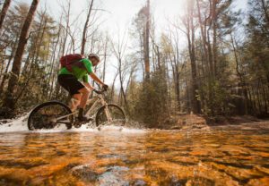
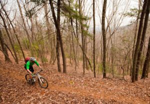
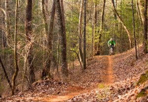
Mountain Biking
The Chattahoochee National Forest near Dahlonega offers some of the best mountain biking to be found in Georgia. Three trails originating in the Chattahoochee National Forest in the Nimblewill area offer a range of difficulty and beautiful scenery. The trails are shared with horseback riders. Care should be taken when approaching horseback riders not to frighten horses.
How to Get There
These trails are reached off of Forest Service Rd. 28-1 between the Nimblewill Road and the Frank D. Merrill Army Ranger Camp. The directions will be given from both ends should you want to arrange for someone to pick you up. To reach FS 28-1 via Nimblewill Rd. from Forrest Hills Resort, turn left out of the resort onto Hwy 52 East. travel 2-3 miles. Nimblewill road will be a paved road on the left with directions to the Nimblewill Baptist Church. Go about 2 miles on Nimblewill Rd. to Forest Service Rd. 28-1 on the right indicated by a sign to Jones Creek and Camp Wahsega. To reach the other end of FS 28-1 at the Ranger camp, go out of Dahlonega on Business US Hwy 19N for 2 miles to Wahsega Rd. on the left indicated by a sign to Camp Frank D. Merrill. From this junction on Hwy. 19 go 8 miles on Wahsega Rd which dead ends at the Ranger camp. Turn left onto FS 28-1. FS 28-1 is a gravel road and is 6.4 miles between the
Bull Mountain Trail – Just minutes from Forrest Hills.
This is easily accessible and one of the most popular trails in the state and is best reached from Nimblewill Rd.. Go 0.3 miles on FS 28-1 and turn left on FS 83. Go 1 miles to parking areas on each side. Bull Mountain Trail is a 11 mile loop with beautiful scenery and long hills. Several options are available to either extend or shorten the ride. Continue on FS 83 0.5 miles to the gate across the road. There is a large parking lot on the right to accommodate horse trailers and limited biker parking. Go around the gate and continue for .2 miles to trail head at wooden steps marked with the trail mark 1C. The first part of this trail is single track and ascends from about 1700 feet to 2500 feet near Bull Mountain. The road straight ahead continues to Lance Creek and the road to the right connects with the Turner Creek and Jake Mountain Trails. At mile 1.3 a single track trail enters from the right.
An alternative is to turn right on this single track trail and go .8 miles until reaching old jeep road. Turn right and go past 3rd cabin and turn right. Continue to intersection of FS 83, turn right and return to starting point.
Otherwise continue on Bull Mountain trail until it reaches the Lance Creek Trail on the right. Take either the Lance Creek Trail for 2.7 miles to gate or take Bare Hare Trail extension 3.4 miles to the gate where the Lance Creek Trail rejoins the Bare Hare Trail. This is the beginning of FS 77A. After the first 100 yards or so the Lance Creek Trail becomes a beautiful ride down along Lance Creek on an old jeep trail. After the two trails join continue on FS 77A and go 0.2 miles to another gate. Immediately after passing gate turn right and ford Lance Creek at mile 8.7. Take second left and turn right onto a single track trail just before cabin at mile 9. Another less strenuous alternative is to continue past this single track trail to the third cabin and take the right on an old jeep trail. Continue until it intersects FS 83, turn right and return to starting point. If you take the single track trail go .8 miles until it rejoins the Bull Mountain Trail, turn left and return to the starting point.
This trail can be extended to 15 miles by remaining on FS 77A instead of crossing Lance Creek. Continue on FS 77A 1.7 miles to FS 77. Turn right and go 1.3 miles to FS 28-1. Turn right on FS 28-1 and continue 1.8 miles to FS 83. Turn right and return to the starting point.